 |
|
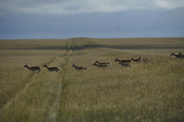
Gazelles cross the Genghis Road, which follows the Wall of Genghis Khan, now a mound that runs across the Eastern Steppe in Mongolia. Chen Xinyu / for china daily |
Explorer William Lindesay undertakes an expedition into the Eastern Steppe to answer questions about the origins of the 'Wall of Genghis Khan'.
Enter the coordinates N49.50', E116.42' into Google Earth and you'll find a place where the borders of China, Mongolia and Russia meet. Around it you'll discover a linear structure, more than 600 km long, that pays no heed to those national borders. Or, it may have been the very first border control in the region. To some, the structure constitutes the remains of a wall; to others, it's a trench and mound; and to others still, a road. Yet one thing is apparent: It runs from southwest to northeast without any significant breaks, though its name changes as it goes.In Mongolia, it's known as the "Chinggisiin Kherem Zam" (Genghis Khan Wall-Road), in China it's called the "Jin Jie Hao" (Jin Dynasty Trench-Mound) and in Russia it's the "Val Chingis Khana" (Genghis Wall).
The longest part of the structure lies within Mongolia, and it became the latest destination in my quest to understand the Great Wall.
In the summer of 2011, I organized my first Genghis Khan Wall expedition to Mongolia's Omnogovi, or "South Gobi" province, and used radiocarbon dating to prove that the wall there dates back to the Western Xia Dynasty, built between the 11th and 12th centuries.
Maps of Mongolia name seven separate portions of this structure the "Wall of Genghis Khan". Located along various compass directions, they have provided me with a few years' worth of expedition material and varied landscape challenges.
Last summer's second expedition promised to be a very different journey, as it would take me and my companions from the Mongolian capital of Ulan Bator, through the country's largest expanse of steppe, to the Mongolia-China border.
The wall on the Eastern Steppe is the most northerly and the most controversial in origin. Sources point to its three possible architects: the Liao (916-1125), the Jin (1115-1234) and, as suggested by its name, Genghis Khan's Yuan Dynasty (1271-1368).
The Official History of Liao mentions the "Border Defense Fortifications", with cavalry deployed along a 750 km length of defenses. It was reportedly built "to make safe land at Jing Bian Cheng, the home of more than 20 tribes united by the Liao, and protect life against the hostilities of the Yujue and Shiwei (tribes)".
Historical atlases also show the northern edge of Liao territory running exactly along the line of the Eastern Steppe's Genghis Khan Wall.
In favor of the Jin is a reference in The Official History of the Jin, mentioning the existence of "Bian Bao" or "Bian Pu", which mean "Border Forts".
Finally, The Secret History of the Mongols, written in the early 13th century, leave some cryptic clues that could be interpreted as reasons for building walls, fences and post stations.
"I established post stations so that our messengers can gallop swiftly toward their goal and transport our necessities," Genghis Khan's son and successor, Ogodei (1185-1241), said.
"Being covetous, and fearing that the wild beasts, born with their destiny determined by Heaven and Earth, would advance onto the lands of my brothers, I had fences and walls of pounded earth constructed," he said.
The leader gave this order despite knowing it was a grave sin. The building of any restraining structure, such as a wall, would have been considered an offense against divine law in Mongol culture, as it interfered with the flow of nature.


